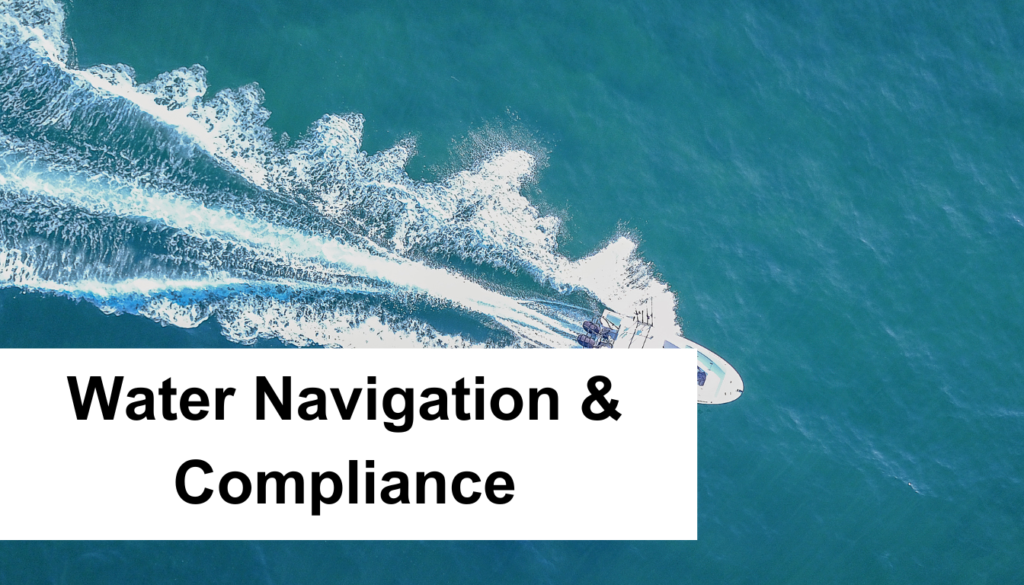
Navigating Safely: Water Navigation & Compliance
As you set sail on the vast oceans, understanding the intricacies of water navigation and safety compliance becomes not just a skill, but a necessity. Swirling beneath the keel of every vessel are the depths of maritime regulations; a robust framework ensuring that your nautical adventures adhere to the highest maritime safety standards.
Whether you’re a seasoned captain or a leisure boater, the waters demand respect and so do the laws governing them. Vast as the sea, the aquatic safety protocols play a pivotal role in charting a course towards sustainable and secure seas. As your hands steer the wheel, it’s crucial that you navigate the nuances of vessel operation laws and boating regulations, designed to safeguard lives and the precious marine environment.
The Importance of Accurate Position Determination in Maritime Navigation
As you brave the vast blue expanse, your command over the vessel hinges on precise location awareness. A mariner’s aptitude in accurate position determination is indispensable for the meticulous execution of waterway navigation rules. Modern seafaring is deeply reliant on technological aids like GPS navigation, which delivers real-time positioning indispensable for following a predetermined route with confidence.
Aligning with celestial objects, celestial navigation techniques speak to the ancient prowess of seafarers, yet they have stood the test of time, providing critical location data when electronic systems might falter. The sun, moon, and stars become reliable guides that ensure a vessel’s progress along its intended path. In congruence, electronic charting systems offer an interactive platform that charts a course while detecting potential hazards.
Here’s a quick comparison of traditional and modern navigation aids:
| Navigation Aid | Usage | Advantages | Limitations |
|---|---|---|---|
| GPS Navigation | Precise global positioning | High accuracy, ease of use | Dependency on satellite signals |
| Celestial Navigation | Positioning via celestial bodies | No reliance on technology, historical significance | Requires clear skies, skilled calculations |
| Electronic Charting Systems | Route planning and real-time tracking | Integrates with other navigational tools, updates automatically | Requires power source and functioning hardware |
The art of navigation is both a heritage and a forward-looking skill. To navigate with foresight and precision, one must master these multifaceted techniques. While doing so, navigators are not merely travelers but guardians of their vessel’s voyage, ensuring safe passage
through the crossroads of tides and time.
Know your position, observe your environment, and apply a blend of time-honored methods and cutting-edge technology. By doing so, you ensure the vessel remains compliant with waterway navigation rules while carving a path through the waves to the journey’s successful conclusion.
Creating and Following Safe Nautical Charts and Routes
When you’re at the helm, the craft of navigating the blue vastness of the ocean relies heavily on the knowledge and application of established marine safety guidelines. Your voyage’s success is determined by the precision of charting and route planning, utilizing essential navigational aids, and an understanding of weather conditions, currents, and potential navigational hazards.
Dynamics of Weather Conditions and Sea Currents
Weather and sea currents are ever-changing elements that can dramatically impact your route and travel time. The unexpected shift in weather patterns or a sudden encounter with strong sea currents can steer you off course or delay your journey. It is crucial to constantly monitor conditions and incorporate real-time data into your navigation strategy to mitigate risks and ensure a timely arrival at your destination.
Navigational Hazards
Wayward icebergs, concealed reefs, busy shipping lanes—they’re all navigational hazards that you might face while traversing the globe’s waterways. Modern technologies such as sonar and radar assist you in detecting and avoiding these dangers, but the mark of a seasoned mariner is also in their ability to comprehend and navigate around these obstacles manually, sometimes under limited visibility conditions.
Depth of Water Considerations
Depth is a critical factor that can be deceptive and potentially dangerous if left unchecked, yet it is frequently overlooked. Shallow waters may not safely support the draft of your vessel, particularly in uncharted territories or areas where sandbanks may have shifted. Up-to-date depth soundings and tide tables need to be part of your navigational routine, ensuring the safe passage of your vessel through varying marine terrains.
| Marine Element | Relevance to Navigation | Tools for Monitoring |
|---|---|---|
| Weather Conditions | Impact visibility, wave height, and wind strength | Barometers, Weather Apps, Satellite Imagery |
| Sea Currents | Affect fuel consumption and course | Current Charts, Online Databases |
| Navigational Hazards | Obstacles that may cause vessel damage | Nautical Charts, RADAR, AIS |
| Water Depth | Essential for avoiding groundings | Depth Sounders, Echo Sounders |
Understanding Dead Reckoning and its Role in Water Navigation
Dead reckoning is an age-old navigational technique that plays a vital role in water navigation. It’s a method by which you can estimate your current position by using a previously known location. Let’s dive into how dead reckoning works and why it’s still important in the age of advanced technology.
Imagine you’re at the helm of a vessel, surrounded by endless blue. Your previous position was known, but with no land in sight, how do you determine where you are now? Dead reckoning requires noting down your heading, speed, and the time elapsed from that last known point. You’ll use this data to plot your course and estimate the vessel’s current position—a process widely referred to as position fixing.
Why is Dead Reckoning Still Relevant?
- Backup Method: In event of GPS or radar failure, dead reckoning serves as a failsafe navigational technique.
- Verification Tool: Electronic systems can err. Confirming your position with dead reckoning reassures you that you’re on the right track, effectively tracking progress of your voyage.
- Understanding Your Movement: It teaches you about your vessel’s capabilities and how external factors like currents and winds affect its movement.
It’s critical that as a navigator, you’re adept at using all available resources to maintain precise track of your position. While electronic aids are convenient, they are not infallible. Dead reckoning acts as a dependable layer of security, ensuring you’re never truly lost at sea.
Now, let’s look at a simplified example of how dead reckoning information might be recorded during a voyage:
| Time | Speed (knots) | Course (True) | Distance Travelled (Nautical Miles) |
|---|---|---|---|
| 0800 | 15 | 090° | 30 |
| 1200 | 15 | 090° | 60 |
| 1600 | 15 | 090° | 90 |
In the example above, you can see how each entry allows you to track the vessel’s progress. By regularly noting down such details, you’re continually updating your vessel’s position fixing, even without satellite-based systems.
In summary, dead reckoning is more than just a historical curiosity; it’s an essential skill that bolsters your navigational acumen, making you a more formidable navigator on the waters. While technology has transformed navigation, dead reckoning remains a foundational practice, reinforcing your ability to confidently pilot in any situation.
Coastal Piloting: Utilizing Visual References and Aids for Safe Navigation
Mastering the art of coastal piloting is essential for any mariner who navigates near shorelines. As you approach coastal waters, natural visual references and navigational aids become crucial for maintaining your course and avoiding hazards. Tools such as lighthouses, buoys, and beacons are your allies in these environments, serving as the eyes along the coast to aid in your successful piloting.
Significance of Lighthouses and Buoys
The sight of a lighthouse piercing through the fog or a brightly colored buoy marking safe water is not just comforting; it’s a critical component of coastal navigation. These structures are not merely relics of the past but remain indispensable in providing visual references which enable you to determine your exact location and steer clear of potential dangers.
- Lighthouses: Traditionally, their powerful beams have been the guiding lights for mariners, marking landfall and key navigational points.
- Buoys: Deployed strategically, they mark channels, warn of hazards, and indicate water depth changes, helping you navigate complex coastal waters safely.
The Role of Beacons and Important Landmarks
Alongside lighthouses and buoys, beacons and notable landmarks also play a pivotal role in the matrix of visual aids for coastal navigation. While a beacon emits a focused light to mark specific locations, landmarks such as prominent buildings or natural features offer a way to confirm your position without relying solely on electronic aides.
As stated by Davis Instruments, knowing how to effectively use these navigational aids is a vital skill for coastal piloting, providing confidence as you traverse the coastal periphery.
The Fundamentals of Celestial Navigation
Celestial navigation stands as one of the oldest and most reliable navigational techniques. Even with technological advancements, knowing how to navigate using celestial bodies is a quintessential skill for mariners, connecting them with a rich maritime history. Davis Instruments emphasize the importance of understanding this practice as it provides a foundation for precise and independent position fixing. Your voyage across the seas can tap into centuries of exploratory expertise when you look to the stars for guidance.
Using Celestial Bodies for Positioning
At sea, GPS systems can fail, but the celestial bodies—the sun, moon, stars, and planets—remain constant. Using instruments like the sextant, navigators measure the angle between a celestial body and the horizon. Armed with these angles and the exact time, you can determine your latitude and longitude. The practice, honed through maritime history, is a celebrated art, embracing the natural cosmic rhythm for terrestrial locational benefits.
A Historical Perspective on Celestial Navigation
Celestial navigation was the GPS of the age of exploration, critical for the successes of figures like Columbus and Magellan. Its principles have been preserved over time, experiencing a resurgence even in the age of digital navigation. Its resilience and time-tested efficacy prove its value in forming today’s comprehensive navigational techniques.
As you learn the constellations and their paths across the sky, you’re also tracing the lines of sailors through centuries—a tribute to those who have skillfully charted the unknown using the celestial sphere.
“Mariners have always known that the stars are key to unlocking the mysteries of the sea. Celestial navigation is our heritage—an organic compass pointing to our place in the world.”
Understanding the connection between past and present navigational methods is more than academic; it’s a navigational imperative. Explorers of yore relied exclusively on the stars, and their knowledge shores up today’s maritime practices. While technology has made celestial navigation less of a necessity, it remains a vital backup skill and a celebrated tradition in seafaring culture.
Navigational Instruments: Modern Tools for Enhanced Maritime Safety
The marine landscape has seen a radical transformation with the integration of sophisticated navigational instruments. These tools not only offer advanced features for optimal voyage planning but also bolster the overarching aspect of maritime safety. Among these modern treasures of maritime navigation, radar technology and depth sounders have evolved into quintessential components for any seafarer.
The Evolution and Usage of Radar Technology
Over the years, radar technology has progressed from a rudimentary detection system to an intricate navigational aid capable of providing detailed situational awareness. Whether you’re navigating a crowded shipping lane or confronting the perils of limited visibility, radar acts as your eyes on the waters, unveiling what might otherwise be hidden threats.
Depth Sounders and their Importance
When it comes to ensuring that your vessel does not run aground, depth sounders are invaluable. These nifty devices enable mariners to measure the water depth beneath the keel, providing real-time insights into underwater topography. This critical information facilitates the safe passage of ships, especially when traversing shallow or unknown waters.
Let’s dive a little deeper into the specifications and functionalities of these two critical components of modern maritime navigation:
| Feature | Radar Technology | Depth Sounders |
|---|---|---|
| Primary Function | Detection of objects and navigation assistance | Measurement of underwater depth |
| Key Benefit | Enhanced situational awareness | Prevention of groundings |
| Usage Scenarios | High traffic areas, poor visibility conditions | Shallow waters, uncharted territories |
| Evolution | From analog to digital with ARPA and MARPA capabilities | From simple echosounders to multi-beam sonar systems |
| Complementary Tools | Automatic Identification Systems (AIS), chartplotters | GPS systems, nautical charts |
Both radar technology and depth sounders have become integral to the vast array of navigational instruments that ensure modern vessels can sail with the confidence of safety and the guarantee of reaching their destinations intact. As a navigator, harnessing these tools allows you to make informed decisions and navigate with precision, no matter what challenges you may face on the open sea.
Understanding and Complying with Water Navigation and Safety Compliance
As a navigator of the seas, your paramount concern ought to be adherence to the maritime safety standards that govern the vast waters of our planet. You’re not merely suggesting guidelines to follow; observing these rules is a stern legal obligation, instrumental in safeguarding both lives and the marine ecosystem. To this end, being conversant with both vessel operation laws and water navigation regulations is not optional—it’s a necessity.
To bridge gaps in understanding, consider aquatic safety protocols as the bedrock upon which safe voyaging rests. These protocols encompass a myriad of practices, from simple safety drills to the intricacies of navigational course plotting. Each component coalesces to form a sturdy defense against the unpredictable whims of the sea.
Your due diligence is reflected in the degree of your familiarity with these regulations. It is a testament to your professionalism and to your commitment to the craft of navigation. Here’s a distilled essence of what you should keep at the forefront:
- The correct application of COLREGs, ensuring uninhibited, collision-free passage.
- In-depth knowledge of both international and inland waterway rules, providing a secure path through diverse territorial waters.
- Regular updates to and from local maritime authorities, maintaining a situational synergy with evolving laws.
Remember, compliance with maritime laws is not static—it’s an ongoing, dynamic process that adjusts with the times and technologies.
Adaptability is your ally in this endeavor, as is the meticulous documentation of navigational decisions. In the table that follows, we delineate a comparative view of key maritime elements, so you can see how the integration of various protocols impacts vessel operation:
| Maritime Element | Role in Navigation | Compliance Measures |
|---|---|---|
| International Regulations (COLREGs) | Maneuvering and light signaling | Regular training and drills |
| Inland Navigation Rules | Traffic separation and right-of-way | Local waterway familiarization |
| Safety Training | Emergency preparedness | Mock drills and crew briefings |
| Documentation | Record of compliance and inspections | Error-free log-keeping and reporting |
The journey to complete maritime compliance is less tumultuous when your vessel—literal and figurative—is built and navigated in accordance with these foundational waters. By entrenching these practices into your daily operations, you are not only ensuring a secure voyage but also affirming your dedication to preserving the sanctity of the seas. Responsibly navigate, dutifully comply, and set sail with confidence.
International and Inland Waterway Navigation Rules: COLREGS and 72COLREGS
Navigating the vast and complex waterways requires a solid understanding of both international and inland navigation rules. The COLREGS and 72COLREGS are designed to be universally understood and implemented for the safe vessel operation. Knowing these rules is essential for all mariners to navigate safely and to prevent collisions on the water.
The Role of the International Maritime Organization (IMO)
As the principal body for regulating shipping, the IMO is instrumental in the control and management of marine navigation. It is responsible for the creation of the international navigation rules known as the 72COLREGS. These regulations are integral in ensuring that ships of different nationalities can operate together safely and effectively on international seas.
Understanding Demarcation Lines
Distinguishing the exact start and end point of territorial waters is vital for mariners. Demarcation lines serve this purpose, marking the boundaries between inland regulations and the COLREGS. These invisible yet crucial lines are recognized internationally and are paramount for mariners to acknowledge to maintain safe vessel operation and be compliant with the appropriate set of rules.
Maritime Safety Standards: Vessel Operation Laws and Responsibilities
In the realm of maritime navigation, safety is paramount. As a mariner, you bear the weight of adherence to rigorous maritime safety standards, set forth by vessel operation laws. These laws encompass the use of navigational lights and sound signaling devices, which are integral to maintaining safety at sea. Understanding these regulations isn’t just a legal formality—it’s a fundamental aspect of your mariner responsibilities that helps prevent accidents and collisions.
Navigational Lights and Visibility
When darkness blankets the sea or when visibility falters, navigational lights serve as the visual voice of your vessel. These lights communicate your ship’s status, its orientation, and signal its presence to others, providing crucial information that aids in cooperative navigation. The colors and positioning of these lights are not arbitrary; they adhere to an internationally recognized system conceived to convey clear and consistent messages, in accordance with vessel operation laws.
Sound Signaling Devices and their Importance
Sound signaling devices are your audible sentinels. In situations where visual contact is compromised, such as fog or heavy rain, these devices cut through the silent veils with horns, whistles, or other means, to alert nearby vessels of your presence and intentions. Their use is governed by stringent regulations, reflecting their importance in reducing the risk of collision and ensuring maritime communication is crystal clear amidst the vagaries of sea travel.
| Signal Type | Visibility Conditions | Usage |
|---|---|---|
| Navigational Lights | Night, Low-visibility | Permanent – Convey operational status, orientation, and presence |
| Sound Signaling Devices | Fog, Heavy Rain | As Needed – Communicate proximity and maneuvers to other vessels |
Marine Pollution Prevention: How Watercraft Operators Can Comply
Protecting the marine environment is a critical concern for watercraft operators worldwide. As part of the collaborative effort to ensure cleaner and healthier oceans, it’s essential to adhere to stringent pollution prevention laws and practices. Understanding and implementing these measures is not only a legal obligation but also an ethical one, reflecting your commitment to environmental protection.
Regulatory Placards and Information Dissemination
To foster watercraft operator compliance, one effective strategy is the use of regulatory placards. These signs serve as constant reminders for crews and passengers alike about the importance of preventing pollutants from entering marine ecosystems. Displayed prominently on vessels, they provide crucial information on proper waste management procedures and pollution reporting channels.
Adhering to International Environmental Protection Laws
Navigating the waters of pollution laws can be as daunting as steering through a stormy sea. However, it’s your responsibility to stay current with the latest international environmental protection laws. This includes regulations such as the International Convention for the Prevention of Pollution from Ships (MARPOL), which outlines specific protocols for handling various types of ship-generated waste.
| Type of Discharge | Placard Required | Regulatory Reference |
|---|---|---|
| Oil | Oil Discharge Prevention | MARPOL Annex I |
| Garbage | Garbage Management | MARPOL Annex V |
| Sewage | Sewage Discharge Restrictions | MARPOL Annex IV |
| Noxious Liquid Substances | NLS Discharge Criteria | MARPOL Annex II |
| Exhaust Emissions | Air Pollution Prevention | MARPOL Annex VI |
Navigational Challenges: Vessels with Special Considerations
Operating a vessel at sea often involves navigating a complex set of challenges that can vary greatly depending on the unique characteristics of each ship. Factors such as draft constraints and special construction features necessitate careful consideration and planning to ensure safety in compliance with maritime regulations.
Accommodating Vessels with Draft Constraints
As you plan your route, navigational challenges can present themselves in the form of draft constraints, which limit the depth of water a ship can safely navigate. Such restrictions are particularly relevant in shallow water areas or ports with depth limitations, where large vessels with significant drafts might face accessibility issues.
Certificates of Alternative Compliance for Unique Vessels
For vessels with unique builds or functional specifications that differ from standard vessel types, the U.S. Coast Guard may grant Certificates of Alternative Compliance. These certificates are critical in acknowledging and validating that such special construction vessels, despite their differences, strive to meet the same rigorous standards set forth in maritime laws to the greatest extent possible.
| Vessel Type | Common Navigational Challenge | Compliance Solution |
|---|---|---|
| Container Ships | Deep draft requires deep water ports | Route planning to avoid shallow passageways |
| Bulk Carriers | Size may restrict maneuverability | Special handling techniques and pilotage services |
| Offshore Support Vessels | Equipment affects height and weight distribution | Alternative compliance for equipment installation |
Monitoring Your Vessel’s Passage
As a vigilant navigator, passage monitoring is essential to your responsibility for maintaining the vessel’s safety and efficiency. This process of continuous monitoring ensures that your vessel’s progress aligns with planned routes and safe navigation practices. In a dynamic marine environment, it is crucial to adapt to changing conditions to safeguard your voyage.
To achieve a comprehensive overview of your vessel’s progress, you’ll need to factor in elements such as wind and currents. Regularly updating your vessel’s position against the intended course enables you to make informed decisions on the fly. Here’s how you can effectively monitor your passage:
- Compare your vessel’s actual position with the planned route using reliable GPS and radar systems.
- Take note of environmental changes and adjust your course to counteract the influence of wind and currents.
- Employ both electronic tools and visual confirmation to verify your vessel’s location.
- Record all observations and course adjustments to maintain an accurate journey log.
Through diligent application of these monitoring practices, you will ensure the safe navigation of your vessel, adeptly navigating through potential hazards and keeping your crew and cargo secure.
Conclusion
Navigational safety, a cornerstone of seafaring, hinges on rigorous adherence to maritime compliance. As navigators and waterborne explorers, your unwavering commitment to nautical expertise serves as the strongest safeguard against the unpredictable nature of the sea. Employing safe boating regulations is not merely a procedural necessity but a duty to every soul aboard and the vast marine environment which envelopes them. The tools and techniques, from GPS navigation to coastal piloting, are the lifelines of maritime navigation that prevent incidents and guide journeys to their safe harbor.
The realm of maritime compliance mandates a deep understanding and application of international and local safe boating regulations. This symbiosis between skill and adherence plays a pivotal role in ensuring that each voyage complies with these standards, minimizing risks and promoting navigational proficiency. Your role as stewards of the blue frontier is not only to navigate but also to protect, embracing seafaring best practices as a testament to your dedication to preserving our waterways and their inhabitants.
As we have explored, the essence of secure and responsible seafaring is a tapestry woven with the threads of technology, knowledge, and conscientious practice. Use the tools and insights shared here to navigate with confidence and precision. Your vigilance in maintaining these high standards of navigational safety reaffirms a collective commitment to upholding the repute of the maritime community. It is within your hands to honor these timeless traditions and foster a legacy of safe and respectful seafaring for generations to come.
FAQ
What is water navigation and safety compliance?
Water navigation and safety compliance encompasses adhering to established rules and guidelines designed to ensure the safety of mariners and the protection of the marine environment. This includes elements like plotting a vessel’s course, using appropriate navigational tools, and adhering to maritime safety standards and vessel operation laws, among others.
How important is accurate position determination in maritime navigation?
Accurate position determination is crucial for maritime navigation as it is the foundation of plotting a vessel’s position and charting a safe course. This process often involves GPS, celestial navigation techniques, and electronic charting systems to ensure a vessel’s safe passage.
What factors must be considered when creating and following nautical charts and routes?
Mariners must take into account the dynamics of weather conditions, sea currents, and navigational hazards. It is essential to consider the depth of water to prevent groundings, as well as use navigational aids and environmental data to design safe and efficient routes.
What is dead reckoning in water navigation?
Dead reckoning is a navigational technique that involves estimating one’s current position based on a previously known point, taking into account factors such as speed, heading, and time elapsed. It is a critical method of position fixing and tracking progress, especially when electronic aids are unreliable or unavailable.
What is the importance of visual references in coastal piloting?
In coastal piloting, visual references such as lighthouses, buoys, and beacons are crucial for safe navigation. They help mariners to determine their location and navigate safely along coastlines and through confined waters by providing essential information and guidance.
How does celestial navigation work?
Celestial navigation is a method of determining a vessel’s position at sea by observing celestial bodies like the sun, moon, stars, and planets. It involves measuring their angles relative to the horizon and using these measurements to calculate the vessel’s latitude and longitude.
Why are modern navigational instruments important for maritime safety?
Navigational instruments such as compasses, sextants, RADAR, and depth sounders provide mariners with advanced capabilities to detect obstacles, assess surroundings, and navigate accurately. These tools are critical for safe sea voyages and contribute significantly to maritime safety.
What regulations must be followed for water navigation and safety compliance?
Mariners must follow international regulations such as COLREGS and inland navigation laws, adhering to maritime safety standards, vessel operation laws, and aquatic safety protocols. Compliance is a legal requirement and is essential for ensuring safety at sea and environmental protection.
How do COLREGS and 72COLREGS affect vessel operation?
COLREGS (International Regulations for Preventing Collisions at Sea) and 72COLREGS provide guidelines for navigating vessels to prevent collisions. These rules dictate how vessels should act in the presence of each other and are essential for safe vessel operation both internationally and in inland waters.
What are some key maritime safety standards concerning vessel operations?
Key maritime safety standards related to vessel operations include the proper use of navigational lights and sound signaling devices. These ensure visibility and communication, respectively, and are critical for preventing collisions and maintaining safety on the water.
What can watercraft operators do to comply with marine pollution prevention laws?
Watercraft operators can comply with marine pollution prevention laws by following rules to prevent contaminant discharge, displaying regulatory placards, and adhering to international environmental protection laws designed to preserve marine ecosystems.
How are navigational challenges for special vessels handled?
Vessels with draft constraints or unique constructions may require special navigational strategies. The U.S. Coast Guard can issue Certificates of Alternative Compliance to ensure these vessels adhere as closely as possible to standard navigational rules while considering their specific limitations.
Why is continuous passage monitoring important?
Continuous passage monitoring involves regularly assessing a vessel’s progress and making necessary course adjustments based on varying conditions such as wind, current, and weather. This process is vital for mitigating risks and ensuring the safety of the vessel’s journey.